
If you’ve ever wondered how many feet above sea level is Houston, you’re not alone. Houston is one of the largest cities in the United States and is known for its proximity to the Gulf Coast, extensive bayou system, and occasional flooding concerns. Understanding the city’s elevation can help residents, visitors, and property buyers better understand the area’s geography and environmental challenges.
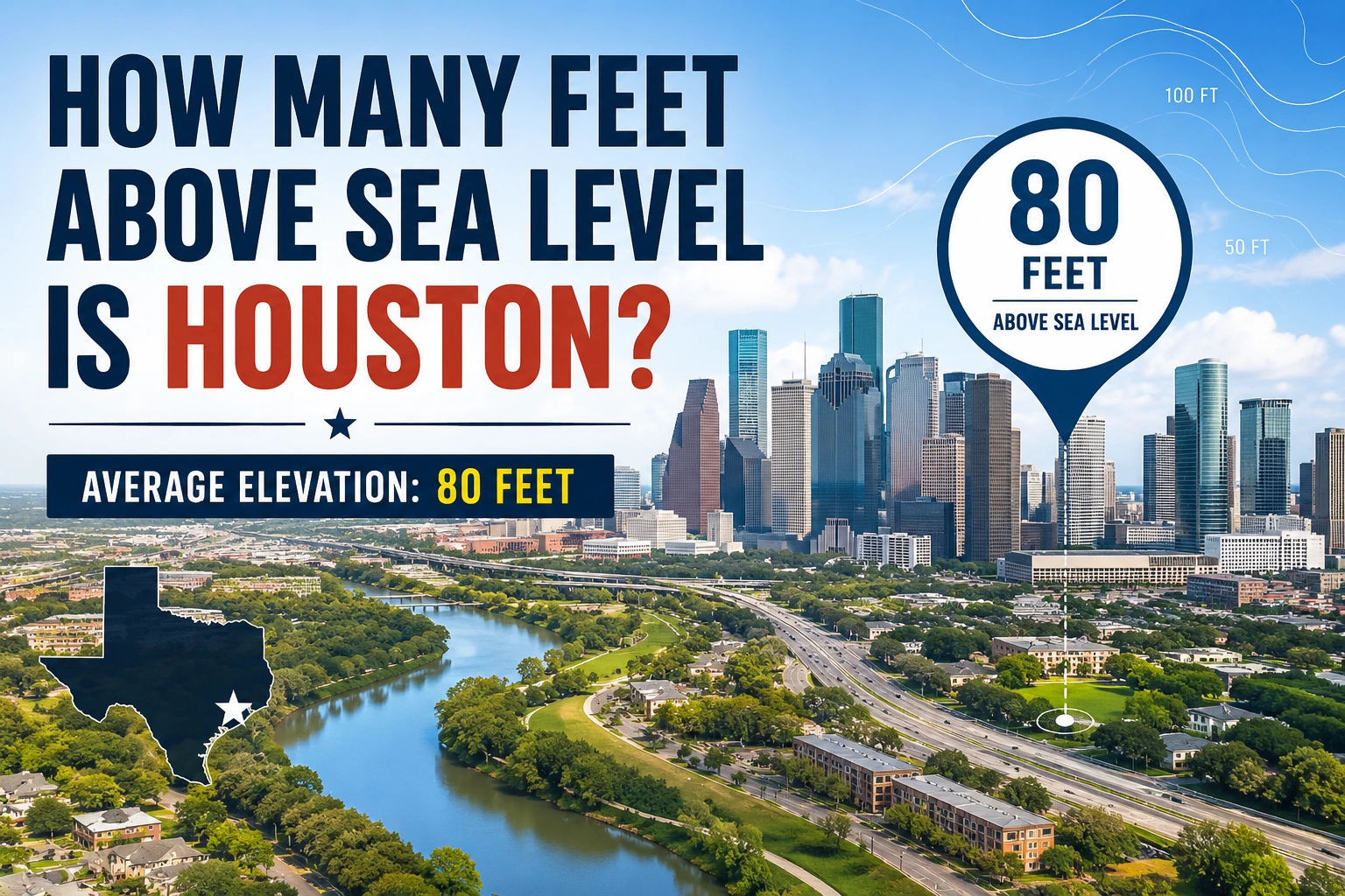
The average elevation of Houston is approximately 80 feet (24 meters) above sea level. However, elevation varies across the city, with some areas sitting much lower and others significantly higher.
In this guide, we’ll explore Houston’s elevation, why it matters, how it compares to other cities, and what it means for flooding, hurricanes, and future development.
Quick Answer: Houston’s Elevation Above Sea Level
The direct answer to the question “how many feet above sea level is Houston” is:
| Location | Elevation |
|---|---|
| Average Houston Elevation | 80 feet (24 m) |
| Downtown Houston | Around 50–80 feet |
| Lowest Areas | 0–20 feet |
| Highest Areas | 150–200 feet |
Although Houston’s average elevation is about 80 feet, the city’s terrain is not perfectly uniform. Different neighborhoods and suburbs have varying elevations.
Understanding Elevation and Sea Level
Before diving deeper into Houston’s geography, it helps to understand what elevation means.
What Does Above Sea Level Mean?
Elevation refers to the height of a location relative to mean sea level, which is the average level of the ocean’s surface.
When we say Houston is 80 feet above sea level, it means the city’s average ground level sits approximately 80 feet higher than the average ocean surface.
How Elevation Is Measured
Elevation measurements are determined using:
- GPS technology
- Satellite mapping
- Topographic surveys
- Geological studies
- Digital elevation models (DEMs)
These tools help create accurate maps showing elevation differences across regions.
What Is the Average Elevation of Houston?
Houston lies on the Gulf Coastal Plain, one of the flattest regions in Texas. As a result, elevation changes gradually across the metropolitan area.
The city’s average elevation is:
80 feet (24 meters) above sea level
However, local elevation varies significantly depending on location.
Elevation in Different Parts of Houston
| Area | Approximate Elevation |
| Downtown Houston | 50–80 feet |
| Houston Ship Channel | 10–30 feet |
| Clear Lake Area | 5–20 feet |
| Katy | 125–150 feet |
| Cypress | 100–150 feet |
| The Woodlands | 150–200 feet |
| Sugar Land | 70–100 feet |
These differences may seem small, but they can greatly impact drainage and flood risk.
Lowest and Highest Points
The lowest parts of Houston are located near:
- Galveston Bay
- Houston Ship Channel
- Coastal wetlands
- Bayou floodplains
The highest areas are generally found in:
- Northwest Houston
- The Woodlands
- Northern suburbs
- Elevated ridges along ancient river systems
Why Is Houston’s Elevation Important?
Houston’s elevation influences many aspects of daily life.
Flood Risk
One of the biggest reasons people search for Houston elevation above sea level is flood awareness.
Because much of Houston sits relatively low and flat:
- Rainwater drains slowly
- Flooding can occur during heavy storms
- Bayous may overflow
- Urban development increases runoff
Even small elevation differences can affect how floodwater moves through neighborhoods.
Hurricane Impact
Houston’s location near the Gulf of Mexico makes it vulnerable to hurricanes.
Lower-elevation areas may experience:
- Storm surge
- Coastal flooding
- Bay flooding
- Infrastructure damage
Areas at higher elevations generally face less direct storm-surge risk.
Real Estate Considerations
Home buyers often check elevation before purchasing property.
Higher elevations may offer:
- Reduced flood risk
- Lower insurance costs
- Better drainage
- Improved property value stability
Elevation data has become an important factor in Houston real estate decisions.
Houston Compared to Other Major U.S. Cities
Many people are surprised to learn how low Houston sits compared to other large American cities.
| City | Average Elevation |
| Houston | 80 ft |
| New Orleans | -6 to 8 ft |
| Miami | 6 ft |
| Dallas | 430 ft |
| Atlanta | 1,050 ft |
| Denver | 5,280 ft |
| Phoenix | 1,086 ft |
Houston is higher than some coastal cities like Miami but much lower than inland cities such as Dallas or Atlanta.
How Houston’s Geography Affects Elevation
Houston’s elevation is closely linked to its geological history.
Gulf Coastal Plain
Houston sits on the Gulf Coastal Plain, a broad, gently sloping region extending along the Gulf Coast.
Characteristics include:
- Flat terrain
- Slow-moving rivers
- Wetlands
- Marshes
- Coastal prairies
These features contribute to Houston’s relatively low elevation.
Flat Terrain Characteristics
Houston is famous for being flat.
Benefits include:
- Easier construction
- Efficient transportation networks
- Urban expansion opportunities
Challenges include:
- Drainage issues
- Flooding concerns
- Water accumulation during storms
The flat landscape is one reason flood management remains a major priority.
Is Houston Below Sea Level?
A common misconception is that Houston is below sea level.
The answer is:
No, Houston is not below sea level.
Most of the city sits above sea level, averaging about 80 feet.
However, some isolated areas near waterways, marshes, and coastal zones may sit very close to sea level.
This confusion often arises because:
- Houston experiences flooding
- The terrain is extremely flat
- Nearby coastal regions have very low elevations
Unlike parts of New Orleans, Houston generally remains above sea level.
How Sea Level Rise Could Affect Houston
Sea level rise is an important topic for Gulf Coast communities.
Potential impacts include:
- Increased coastal flooding
- More severe storm surge events
- Wetland loss
- Infrastructure challenges
- Changes to drainage systems
Although central Houston is inland, nearby coastal areas may experience greater impacts over time.
Scientists and city planners continue to monitor sea-level trends and develop adaptation strategies.
Elevation and Flood Zones in Houston
Elevation plays a major role in determining flood zones.
Areas with lower elevations are generally more likely to experience:
- Flash flooding
- River flooding
- Stormwater accumulation
However, elevation alone does not determine flood risk.
Other factors include:
- Drainage infrastructure
- Soil type
- Nearby waterways
- Rainfall intensity
- Urban development
A higher-elevation home may still flood if drainage systems become overwhelmed.
Practical Uses of Knowing Houston’s Elevation
Understanding Houston’s elevation can be useful for many reasons.
For Homeowners
- Evaluate flood risk
- Understand drainage patterns
- Compare insurance costs
For Property Investors
- Assess long-term property value
- Analyze environmental risks
- Make informed investment decisions
For Travelers
- Learn about local geography
- Understand weather-related challenges
For Students
- Study Texas geography
- Understand coastal environments
- Explore urban planning topics
Common Misconceptions About Houston’s Elevation
Several myths persist about Houston’s altitude.
Myth 1: Houston Is Below Sea Level
False.
Most of Houston sits above sea level.
Myth 2: All Parts of Houston Have the Same Elevation
False.
Elevation varies considerably between neighborhoods.
Myth 3: Higher Elevation Guarantees No Flooding
False.
Flooding depends on multiple factors beyond elevation alone.
Myth 4: Houston Is One of the Lowest Cities in America
Partially true.
Houston is relatively low, but many coastal cities sit even lower.
Expert Tips for Residents and Property Buyers
If elevation matters to your decision-making, consider these tips:
Check FEMA Flood Maps
Flood maps provide important information about risk zones.
Review Property Elevation Certificates
These documents show the exact elevation of a structure.
Study Local Drainage Systems
Good drainage can significantly reduce flood risk.
Compare Neighborhood Elevations
Even a difference of 10–20 feet can influence flood exposure.
Consider Long-Term Climate Trends
Future environmental conditions may affect low-lying areas more than higher-elevation locations.
Frequently Asked Questions
1. How many feet above sea level is Houston?
Houston’s average elevation is approximately 80 feet (24 meters) above sea level.
2. Is Houston below sea level?
No. Houston is generally above sea level, although some nearby coastal areas are very low.
3. What is the elevation of downtown Houston?
Downtown Houston typically ranges from about 50 to 80 feet above sea level.
4. Why does Houston flood if it is above sea level?
Flooding occurs due to heavy rainfall, flat terrain, drainage limitations, and nearby waterways rather than being below sea level.
5. What part of Houston has the highest elevation?
Northwestern suburbs and areas such as The Woodlands generally have some of the highest elevations in the Houston metropolitan region.
Conclusion
So, how many feet above sea level is Houston? The city has an average elevation of approximately 80 feet above sea level, though elevations vary across neighborhoods and surrounding suburbs. While Houston is not below sea level, its relatively low elevation and flat terrain contribute to flooding concerns during heavy rainfall and hurricanes.
Understanding Houston’s elevation helps homeowners, investors, travelers, and residents make informed decisions about property, safety, and long-term planning. Whether you’re researching flood risk or simply curious about Texas geography, knowing the elevation of Houston provides valuable insight into how the city functions and develops along the Gulf Coast.
Discover more
how many feet of tubing in a trumpet