
Many people wonder, how many feet above sea level is Chicago and why that number matters. Chicago is one of the most famous cities in the United States, known for its skyline, deep-dish pizza, sports teams, and location along Lake Michigan. But its elevation also plays an important role in weather, drainage, climate, and city planning.
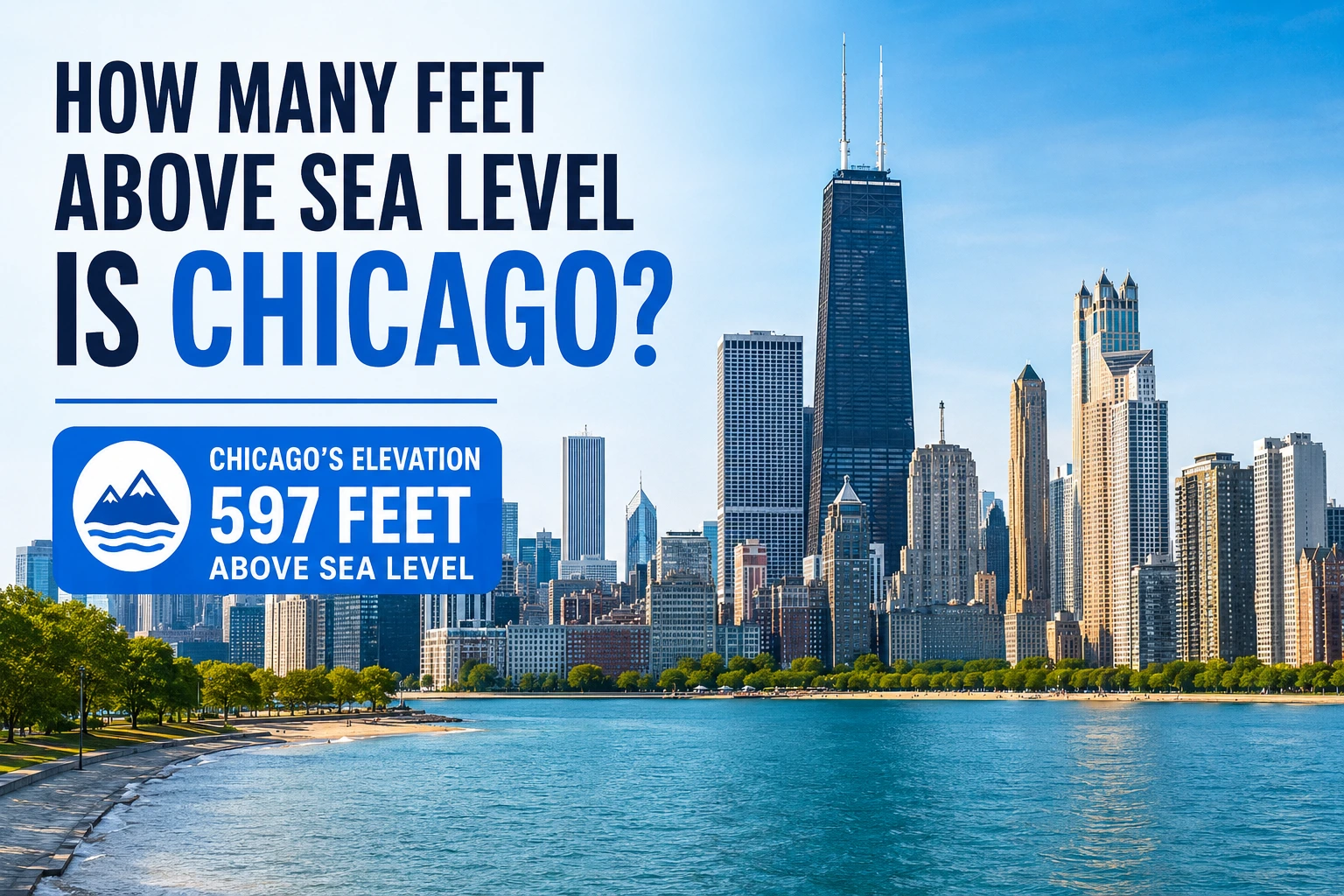
Chicago sits at an average elevation of approximately 597 feet (182 meters) above sea level. However, elevation can vary slightly depending on the exact location within the city.
Although Chicago is relatively flat compared to mountain cities, its elevation still affects everything from winter snowstorms to flood management. Understanding Chicago’s elevation also helps explain why the city was historically important for transportation and trade.
In this guide, you’ll learn:
- Chicago’s exact elevation
- Why elevation matters
- How Chicago compares to other cities
- Whether Chicago faces sea level rise risks
- How elevation affects weather and flooding
- Interesting geographical facts about the city
What Is Chicago’s Elevation Above Sea Level?
The average elevation of Chicago is:
597 feet above sea level
That means the city is nearly 600 feet higher than the average level of the world’s oceans.
Chicago’s elevation is measured relative to mean sea level, which is the average ocean surface height used worldwide as a standard reference point.
Because Chicago covers a large area, elevation changes slightly across neighborhoods. Some locations are closer to 580 feet, while others rise above 620 feet.
Average Elevation by Area
| Area of Chicago | Approximate Elevation |
|---|---|
| Downtown Chicago | 594–600 feet |
| Near Lake Michigan | 580–590 feet |
| Western neighborhoods | 610–620 feet |
| O’Hare Airport area | Around 668 feet |
Overall, Chicago remains a relatively low and flat city compared to mountainous regions.
Why Chicago’s Elevation Matters
You might think elevation only matters in mountain towns, but it also affects major cities like Chicago in several ways.
1. Weather and Temperature
Higher elevations are usually cooler. Since Chicago’s elevation is moderate, temperature changes are influenced more by Lake Michigan than altitude.
However, elevation still affects:
- Wind patterns
- Snow accumulation
- Storm drainage
- Air pressure
2. Flood Control
Chicago’s elevation helped engineers design one of the most advanced drainage systems in the country.
The city even reversed the flow of the Chicago River in the early 1900s to improve sanitation and water management.
3. Transportation and Trade
Chicago’s location above sea level and near the Great Lakes made it a major transportation hub.
Its elevation provided stable ground for:
- Railroads
- Roads
- Industrial buildings
- Shipping infrastructure
4. Urban Development
Flat terrain made construction easier. That helped Chicago expand rapidly during the 19th and 20th centuries.
How Elevation Is Measured
Elevation refers to the height of a location relative to sea level.
Surveyors and scientists use tools such as:
- GPS systems
- Satellite mapping
- Topographic surveys
- Laser scanning technology
In cities like Chicago, measurements are usually based on mean sea level standards established by national geographic agencies.
Feet vs Meters
Chicago’s elevation can also be expressed in metric form:
597 feet≈182 meters
The United States commonly uses feet, while most countries use meters.
Chicago’s Elevation Compared to Other Major Cities
Chicago’s elevation is moderate when compared with other American cities.
| City | Elevation Above Sea Level |
|---|---|
| Chicago | 597 feet |
| New York City | 33 feet |
| Miami | 6 feet |
| Denver | 5,280 feet |
| Los Angeles | 305 feet |
| Dallas | 430 feet |
| Seattle | 174 feet |
What This Comparison Shows
- Chicago is much higher than coastal cities like Miami and New York.
- It is far lower than mountain cities like Denver.
- Its elevation helps reduce direct ocean flooding risks.
Because Chicago is inland, it is less threatened by hurricanes and storm surges than coastal cities.
Does Chicago’s Elevation Affect Weather?
Yes, but not as much as you may think.
Chicago’s climate is influenced more by:
- Lake Michigan
- Northern latitude
- Seasonal air masses
Still, elevation contributes to local weather conditions.
Winter Snow and Wind
Chicago’s relatively flat terrain allows cold winds to move freely across the city.
This creates:
- Wind chill effects
- Snow drifting
- Rapid weather changes
Rainwater Drainage
The city’s gentle elevation slopes help stormwater flow toward drainage systems and waterways.
Without careful engineering, flat cities can face severe flooding problems.
Is Chicago at Risk From Rising Sea Levels?
A common question is whether Chicago could flood because of rising oceans.
The short answer is: Chicago is not directly threatened by ocean sea level rise because it is far inland.
However, climate change can still affect the city through:
- Heavy rainfall
- Lake Michigan water fluctuations
- Urban flooding
- Sewer overflow issues
Why Chicago Is Safer Than Coastal Cities
Chicago sits hundreds of miles away from the Atlantic Ocean and Gulf Coast.
Its elevation of nearly 600 feet above sea level gives it a major advantage over cities such as:
- Miami
- New Orleans
- Charleston
Those cities face much greater flood risks from rising oceans and hurricanes.
Elevation Differences Across Chicago
Chicago may look flat, but small elevation changes exist throughout the city.
Lower Areas
Neighborhoods close to Lake Michigan tend to be lower.
These areas can sometimes experience:
- Shoreline flooding
- Storm surge from lake storms
- Basement flooding after heavy rain
Higher Areas
Western and northwestern parts of Chicago sit slightly higher.
These areas generally have:
- Better drainage
- Less shoreline risk
- Different soil conditions
Why Small Elevation Changes Matter
Even a difference of 10–20 feet can influence:
- Property values
- Flood insurance
- Construction planning
- Infrastructure design
Chicago and Lake Michigan Elevation
Lake Michigan itself sits at approximately:
577 feet above sea level
That means Chicago is only slightly higher than the lake in many places.
This close relationship explains why water management is such an important issue in the city.
Impact of Lake Michigan
Lake Michigan affects Chicago by influencing:
- Temperature
- Snowfall
- Humidity
- Wind patterns
During winter, the lake can produce lake-effect snow. During summer, it helps cool nearby neighborhoods.
Interesting Facts About Chicago’s Geography
Chicago’s geography is more fascinating than many people realize.
The City Was Raised Higher
In the 1850s and 1860s, parts of Chicago were physically lifted several feet higher to improve drainage.
Entire buildings were raised using hydraulic jacks.
This was one of the largest engineering projects of its time.
Chicago Is Extremely Flat
Compared to many American cities, Chicago has very little natural elevation variation.
That flatness helped create the city’s famous grid street system.
Glaciers Shaped the Region
Thousands of years ago, glaciers carved out the Great Lakes region.
When the glaciers melted, they left behind the landforms that now define Chicago and Lake Michigan.
Common Misconceptions About Chicago’s Elevation
“Chicago Is at Sea Level”
This is false. Chicago is nearly 600 feet above sea level.
“Chicago Faces Ocean Flooding”
Because Chicago is inland, it does not face direct ocean flooding like coastal cities.
“Flat Cities Have No Elevation”
Even flat cities have measurable elevation changes that affect drainage and development.
How Chicago’s Elevation Impacts Daily Life
Most residents rarely think about elevation, but it affects daily life in many ways.
Construction
Builders must account for:
- Drainage systems
- Foundation stability
- Underground water flow
Transportation
Roads and railways benefit from relatively flat terrain, making travel easier and infrastructure cheaper to build.
Real Estate
Elevation can influence:
- Flood risk
- Insurance rates
- Basement water issues
- Property desirability
Outdoor Activities
Cycling and walking are popular partly because Chicago lacks steep hills.
Expert Tips for Understanding City Elevation
If you want to better understand a city’s elevation, keep these tips in mind:
Check Average vs Specific Elevation
Cities can vary widely by neighborhood.
Look at Water Sources
Cities near lakes or oceans often have lower elevations.
Understand Local Geography
Mountains, valleys, rivers, and glaciers all shape elevation patterns.
Use Elevation Maps
Topographic maps and digital elevation tools provide accurate local measurements.
FAQs
1. How many feet above sea level is downtown Chicago?
Downtown Chicago is generally around 594 to 600 feet above sea level.
2. Is Chicago below sea level?
No. Chicago sits well above sea level at approximately 597 feet.
3. What is Chicago’s elevation in meters?
Chicago’s average elevation is about 182 meters above sea level.
4. Does Lake Michigan affect Chicago’s elevation?
Lake Michigan does not change Chicago’s elevation, but it strongly affects weather, flooding, and local climate.
5. Is Chicago higher than New York City?
Yes. Chicago is much higher above sea level than New York City, which averages only about 33 feet above sea level.
Conclusion
So, how many feet above sea level is Chicago? The city sits at an average elevation of approximately 597 feet above sea level, making it significantly higher than many coastal cities in the United States.
Chicago’s elevation influences weather, drainage, transportation, construction, and flood management. Although the city is relatively flat, even small elevation differences matter for urban planning and daily life.
Its location near Lake Michigan and far from the ocean gives Chicago a unique geographic advantage. While it still faces challenges from heavy rain and climate change, it is less vulnerable to ocean flooding than many coastal cities.
Understanding Chicago’s elevation helps explain not only the city’s geography but also its history, growth, and modern infrastructure.
Discover more